

Beneath the villas, roads, and construction spreading across western Cairo lies rock formed in an ancient sea roughly 90 million years ago. Today, those limestone layers have a far more modern role: supporting the weight of New Giza’s expanding urban landscape.
A new study published in Discover Geoscience has examined how those rocks behave under pressure at Pyramids Heights, about 16 kilometres west of Cairo. Researchers found that the ground is far from uniform. While some layers provide strong support for buildings, others contain weak, porous, or fractured rock that may require reinforcement before construction. The study was published on September 20.
Lead author El-Hussein M. Ali, a geophysics researcher at Ain Shams University’s Faculty of Science, and his colleagues studied carbonate rocks belonging to the Abu Roash Formation. Their aim was to link the area’s geological history to a practical engineering question: how much weight can different rock layers safely carry?
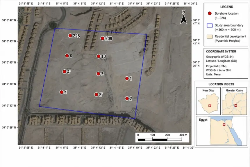
The team worked from a network of 228 boreholes across the site and conducted detailed laboratory testing on 12 selected samples—nine cores taken from boreholes and three blocks collected from the surface. The researchers compressed the samples until they failed, enabling them to measure both their strength and their response to loading.
The results revealed marked differences. Rock strength ranged from 4.93 to 19.69 megapascals, while the amount of pressure the rock could safely support ranged from about 1.25 to 4.99 megapascals. In practical terms, some layers could safely carry substantially heavier loads than others.
According to Ali and his co-authors, these differences are not random. They reflect how the rocks were originally deposited, how some layers were later hardened while others were dissolved by water, and how faults and fractures altered the ground over millions of years. In effect, the rocks retain a geological “memory” that can help engineers anticipate where foundations may perform well—and where problems may be hidden underground.
One layer, known as the Acteonella Series, emerged as the strongest. Its safe bearing capacity reached about 4.8 to 5.0 megapascals, making it the most reliable foundation layer identified by the researchers. By contrast, the Flint Series, which contains chalky limestone, marl, and porous material, performed considerably worse, with values falling to around 1.2 megapascals.
That difference matters because ground that appears solid at the surface may conceal cavities, weak pockets, or fractured rock. Faults add another complication: fractures can provide pathways for water, allowing it to dissolve carbonate rocks and gradually create voids underground.
For the weakest locations, Ali and his colleagues recommend measures such as pressure grouting, which fills underground cavities, or micropiles, which transfer a building’s weight through weak material to stronger rock below. They also argue that fault zones should be incorporated into municipal geographic information system (GIS) maps, enabling planners to identify potentially challenging construction sites before permits are issued.
The approach could extend beyond Pyramids Heights. Similar carbonate formations occur beneath other Egyptian urban expansion areas, including 6th of October City, Sheikh Zayed City, and New Cairo, suggesting that geological mapping could eventually help planners develop broader foundation-suitability maps.
The researchers caution, however, that their detailed laboratory analysis involved only 12 samples and focused on intact pieces of rock. Actual underground rock masses contain fractures, joints, and cavities that can make them weaker. The study therefore calls for additional field testing and broader sampling before its measurements are applied to individual building designs.


